What Does ‘Restoration” Mean?
by Mike Kelly, Conservation Chair
If you follow our newsletter or hike/event schedules you’ll see restoration work parties listed every time. What you may not know is that not all of the restoration work is in City Parks. A lot of work is on properties owned outright by the Friends. The Friends own 8 parcels of land in Rancho Peñasquitos. We’ll tell you about them later in this article. The Friends are organizing restoration projects in both Peñasquitos Canyon and Black Mountain Park. In addition, we are supporting the Chaparral Lands Conservancy’s Master Plan for restoring the Del Mar Mesa. This lengthy article is meant to act as a record of the highlights of our work. Much other restoration work took place with many different volunteers over the decades!
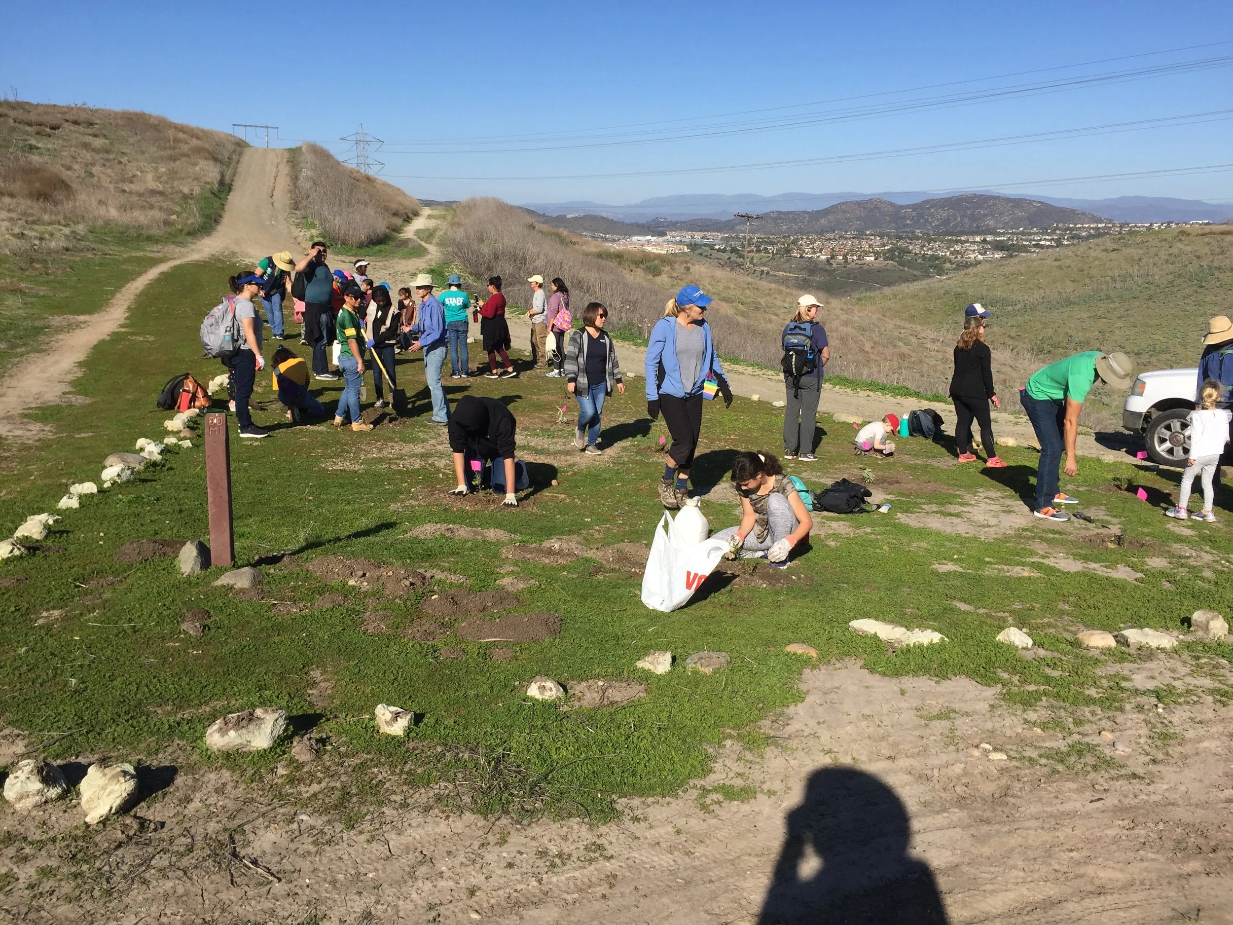

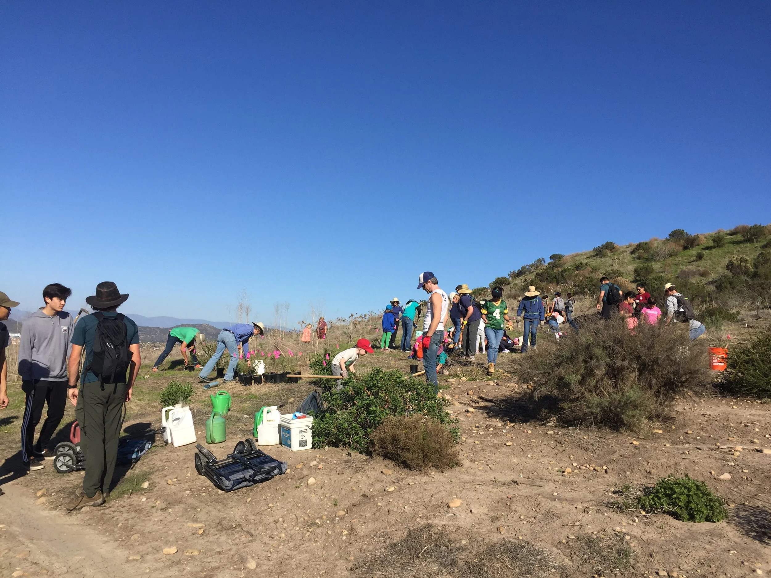
But first, what do we mean by restoration? Much of Peñasquitos Canyon Preserve and Black Mtn. Park has been disturbed by a combination of overgrazing by cattle and destruction of the soil structure by the plowing and discing of agriculture on the land. Much of the native grasslands and scrublands were replaced by non-native invasive weeds. In restoration we first do our best to eliminate or at least reduce these non-natives. Then we choose a palette of native plants to replace the weeds. We can’t replicate an original habitat we have no record of so we use the nearest habitat with the likely palette of species. Then we plant and weed, weed, and weed!
Knowing the limits of our volunteers, the Friends sought and received two grants from the POPs (Protect our Preserves) foundation to carry out restoration projects at Harrier Hill and the Fennel Forest and the Darkwood finger canyon areas, both in Peñasquitos Preserve. The Friends put up matching monies to their generous grants.
Harrier Hill/Fennel Forest. This hill and adjacent grasslands occur at the west end of Peñasquitos Canyon just east of where the trail coming in from the West End Parking Staging Area comes up and over the hill down into the main canyon. For decades Northern Harriers, a.k.a. Marsh hawks, made their nests on the ground on the slope of what we call Harrier Hill.
Our Marsh hawks nested both there and on a grassy hill up Lopez Canyon. Ours liked grassy hills with grass tall enough to hide their nests from predators such as coyotes. [Many Marsh hawks build their nests in the cattails and reeds of marshes.] But the structure of the habitat on Harrier Hill and the adjacent grasslands changed, with tall, stout weeds such as artichoke thistle, sweet fennel, and black mustard. These weeds are not only stout, but also form dense thickets difficult to penetrate by us, never mind a much smaller bird.
Senior City Ranger Gina Washington had identified this hill as important to restore to a habitat suitable, once again, for Marsh hawk nesting. The Friends agreed and got the POPs grant. We hired two contractors to kill the weeds and replant with appropriate natives. The “fennel forest” was a very big, dense patch of sweet fennel (Foeniculum vulgare) near Harrier Hill. Marsh hawks like to hunt in marshes and low-level grasslands, seeking small mammals and birds, sometimes even insects (Wikipedia).
Darkwood Wildlife Corridor. This wildlife corridor runs up a finger canyon alongside a year- round creek on the east side of Park Village Elementary School at Camino del Sur and Park Village Rd in Rancho Peñasquitos. The Canyon runs north to south for over half a mile, extending north of Sundance Rd. It’s a wildlife corridor running from the mouth of the canyon at Park Village Rd. The corridor goes about half way up the canyon, then veers off to the north and west and connects to the Del Mar Mesa. A San Diego Tracking Team survey of the corridor years ago documented the use of the canyon by mule deer, bobcat, coyotes and other critters. A critter cam in the canyon confirms the presence of these same species.
The canyon has a full complement of invasive species displacing natives. They include Canary Island date palms, Mexican fan palms, salt cedar and eucalyptus, pampas grasses, artichoke thistle, fennel, black mustard and others. City Ranger Melanie Fontana provided a map of many of these the city Rangers had surveyed.
The Friends hired Black Sage Environmental to control the invasives, work they carried out in the spring of 2023 on several occasions. Friends’ volunteers did some follow up work in the canyon. There will be several more years of work in this canyon to rid it of these invasive species.
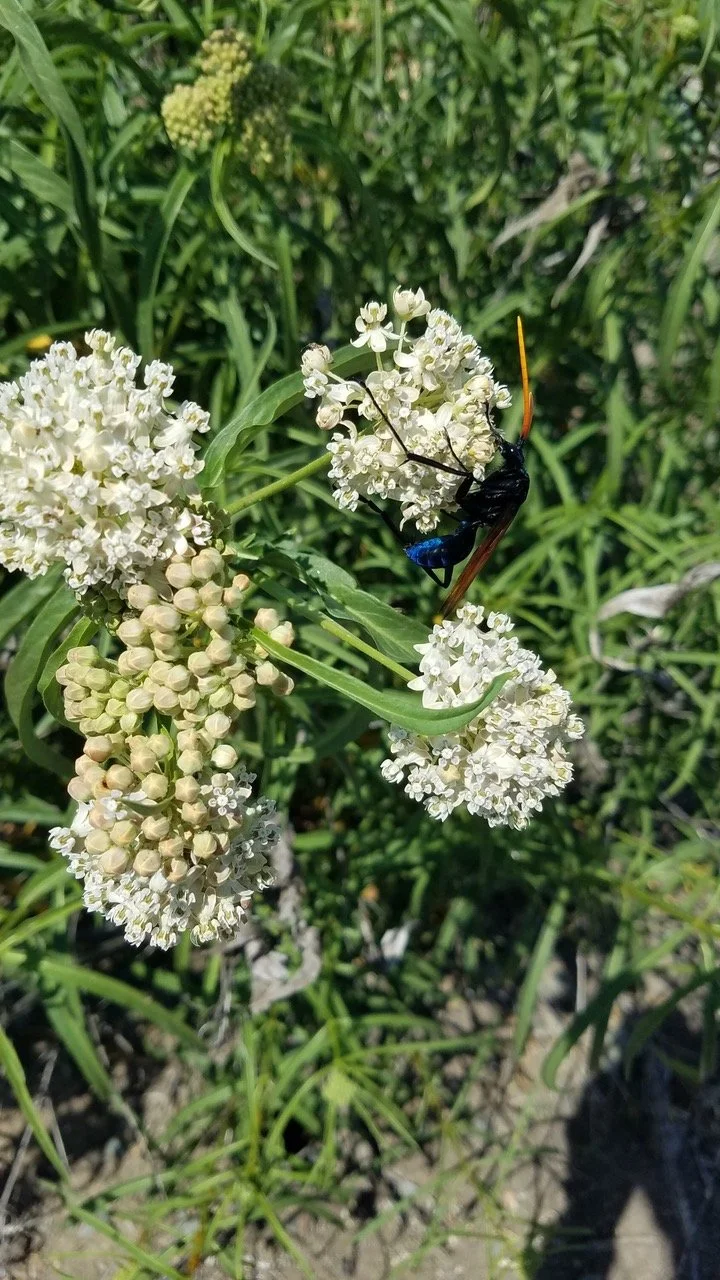
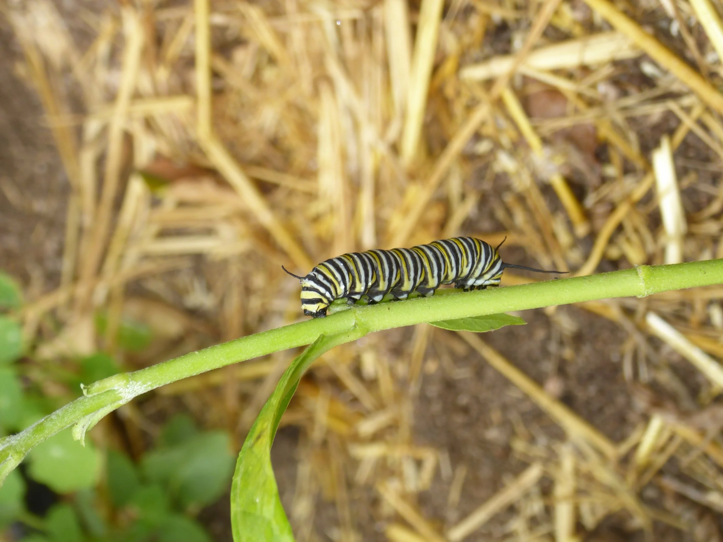
The Friends would like to establish a pollinator habitat in the mouth of the canyon designed to attract and feed Monarch butterflies and other pollinators. We’ll need plenty of volunteer help to make this happen.


Brodiaea filifolia site next to Sundevil Way. This site, part of the north slope of the City’s Black Mtn. Open Space Park, is home to the highly endangered Brodiaea filifolia or Thread leaf Brodiaea. It was discovered by the Kelly & Associates restoration team back in 2010 when they were working this field east of the Mt. Carmel High School. Since then, Friends’ volunteers have been controlling the artichoke thistle, fennel, mustard, bristly oxtongue, latuca and other weeds. The grasslands host a nice variety of native species besides the Brodiaea filifolia. Friends’ volunteers have partnered with the City’s Multiple Species Conservation Plan (MSCP) staff to survey and monitor this population.
Santa Luz arc of sites. When you enter the Santa Luz grasslands part of Black Mtn. Open Space Park through the gate in the northeastern corner of Black Mtn. Ranch Community Park you’re in the middle of an arc of restoration sites. This arc of sites stretches from Doug Hill in the west to the Cactus Point on the Ahwee Trail in the east, a distance of a little over 0.5 mile. The oldest sites are on either side of the entrance. Before restoration began the Santa Luz grasslands, over 2,000 acres, were overwhelmingly non-native invasive species such as the dominant artichoke thistle, joined by wild oats, black mustard, bristly oxtongue, wire lettuce, tamarisk and more. These were the result of over grazing since about the 1870s and agricultural practices that destroyed the native habitat and soil structure. A more recent arrival to the area we are helping to control is Euphorbia terracina, a highly invasive species problematic in the Los Angeles area.
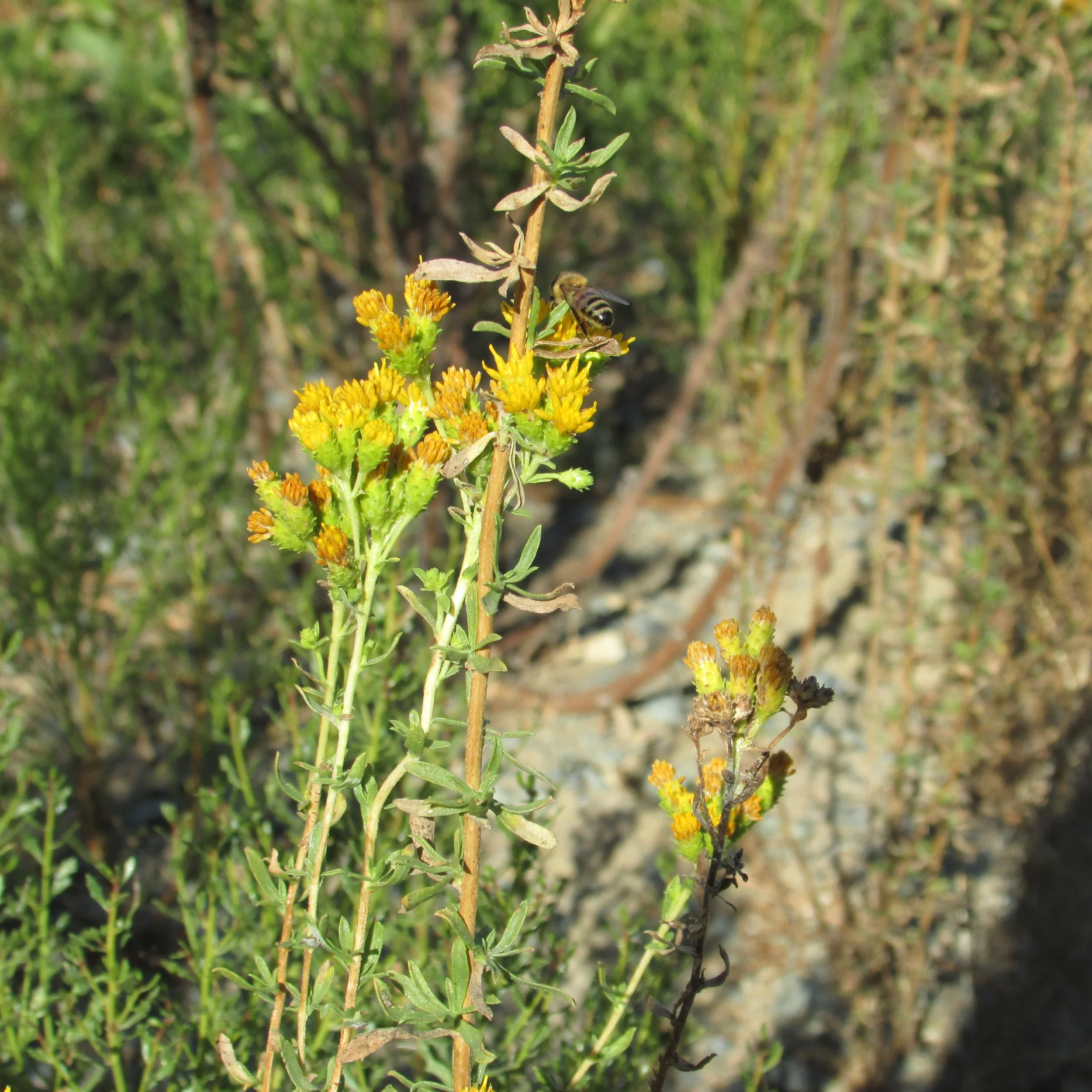
Our restoration goals are focused on bringing back coastal sage scrub habitat suitable for two endangered birds, the Cactus wren and the California gnatcatcher. Gnatcatchers are already present in the more established parts of the sites. We have already established a narrow leaf milkweed population that hopefully will support the Monarch butterfly. In addition, we are trying to establish a swath of native grassland east of the Doug Hill area.
There are four other mature Cactus wren restoration sites on and above Lusardi Creek completed by the Friends years ago. These were funded by grants from the Natural Resources Conservation Service. Prickly pear cactus was planted in the form of many hundred pads harvested from mature cactus patches. Somewhat sparse nearby coastal sage scrub habitat was enhanced by aggressive weeding and planting of species typical of coastal sage scrub habitat.
Ambrosia pumila sites. Ambrosia pumila is another highly endangered plant species. It no longer reproduces sexually (no viable seeds). It does reproduce clonally. Our naturally occurring population near Black Mtn. Road was wiped out when the new, expanded Black Mtn. Road went in. Years later, SDSU’s SERG group proposed experimental transplants of the plant into six plots in PQ Canyon.
The Ambrosia plants came from a population being built upon in Chula Vista I think, by a freeway build. City Ranger Dion Heller and I scouted potential sites and came up with some to run by Dave Bainbridge, a leader of SERG. We agreed upon the sites and SERG transplanted into six sites. They were all different, following an experimental design. Gopher cages in one to see if they increased survivorship. Mulch in another to see if that improved survivorship. Three of the six plots died out quickly, gophers in one case, weeds in two others. There wasn’t as much work being done on the plots as they required and the program ended abruptly for some reason. In any case Bainbridge asked me if the Friends would take over the plots. We said yes and he turned over a wealth of documentation of the species and the plots.
We started pretty consistent weed control in the three remaining plots. One at Black Mtn. Road was big and robust, expanding year over year outside its enclosure as we did aggressive weed control. This site was probably closer in soil conditions than the other two plots west of Black Mtn. Road. One of the other plots is small, but stable with little weed pressure. The other site is in poor soil and under tremendous weed pressure from Erodium. During the COVID shutdown when we had little access as volunteers to the parks, we lost control of the weeds in the Black Mtn. Rd plot and to several native shrubs. We’ll have to do new transplants into this plot to get it going again.
Willowy monardella (Monardella viminea). For more than a quarter of a century the Friends, led by Cindy Burrascano and Mike Kelly, have worked to protect and enhance the populations of this endangered species. Around 2010 the Friends received a grant from the city’s Multiple Species Conservation program to collect the seed of this plant and grow up plants for outplanting in its home range of Lopez Canyon.
Most of the naturally occurring plants of this species were lost to erosion. Development above the headwaters of this canyon caused the runoff waters of a big portion of Mira Mesa to flow into giant storm drains above Montongo Street where it crosses the canyon. The hydrology changed radically and much of the terraces of the central part of the canyon were wiped out by the flood waters. And that’s how many of the plants, not only the naturally occurring ones, but also many of the greenhouse plants were lost. A small number of sites are not yet subject to the erosion power of the flows and we plan to grow and out plant more of this beautiful flower with its minty smell.


Del Mar Mesa Preserve. The Friends granted $150K towards the development of a Programmatic Habitat Restoration and Monitoring Plan for the Del Mar Mesa Preserve developed by Dave Hogan and The Chaparral Lands Conservancy. The plan is a blueprint for restoration of the vernal pools and associated habitat on parcels owned by The California Dept. of Fish and Wildlife, Caltrans, the City of San Diego, San Diego County and U.S. Fish and Wildlife Service. The habitat restoration areas total 176.74 acres of the total size of the Del Mar Mesa of 813.87 acres. Once underway we estimate the project will cost well over $10 million and take 15-20 years to complete.


Special efforts
It’s not widely known but our president, Beth Mather, lives and breathes Black Mtn. Park. Living on one of the slopes of the mountain, she has taken a keen interest in battling invasive weeds for many years. She has gone out by herself too many times to count and sprayed or pulled black mustard, wire lettuce, artichoke thistle, stinkwort, bristly oxtongue and many others. When her bad hip threatened her abilities on the slopes she went out and got herself a new one.
Friends’ Parcels
All 8 are to be conserved for their conservation values in perpetuity. We inherited these parcels from a former land trust that had mismanaged them and their endowments. The Friends maintain a “lock box” endowment at The San Diego Foundation (which the previous owner failed to do). See more details below.
Adobe Bluffs Canyon. Four parcels include this small canyon! It’s bordered by Adobe Bluffs Road and Donaker Way on the north, Waterford Way on the East, Galway Place on the south and Camino del Sur on the west. It’s home to birds, snakes, lizards, insects and a naturally occurring population of narrow leaf milkweed, a species special to the Monarch butterfly. Friends’ volunteers controlled many invasive weeds here over the years but hired a contractor to finish the job this fall. There is a well-groomed public trail on the north side, well maintained by the nearby Homeowners Association, running from Waterford to Camino del Sur.
Mesa Verde Canyon. The Friends also own this small canyon, made up of two parcels, bordered by Dufresne Place on the south, SR 56 on the west and several cul-de-sacs on the north such as Trailhead Place. There was a lot of salt cedar and pampas grass in the canyon, especially below the school site. Artichoke thistle and mustard were also present. While volunteers controlled many of the invasives the Friends hired contractors to crunch the worst part of the canyon. The Poway Unified School District has cooperated with the Friends and permitted access to the part of the canyon that is below Mesa Verde Middle School. This access is the easiest for the Friends to reach this part of the canyon. Bird life here has even included Red-wing blackbirds, a very vocal and sociable species. A coyote den was discovered in 2023.
Vernal pool site. These two pools aren’t holding water long enough to sustain vernal pool species. None have been detected over about a ten-year period. Vernal pools are dependent on an impermeable layer of hardpan or clay and mima mounds or similar structures that form rim boundaries. Development exists on all 4 sides of these isolated pools. A street is on the east side and houses on the north and south sides. A church property is on the west side, but at a much lower elevation. A very sheer slope runs from the western edge a hundred or more feet below to the church and its parking lot.
This slope is not a natural one, but a manufactured cut and sheer slope. The neighbor to the north lived there when the church property was constructed and reports seeing the parcel dewatering off the back slope after that. Our thought is that the impermeable basin was damaged at this time, destroying the integrity of the pools. There are only a couple of native shrubs and grasses on the parcel. Otherwise, it’s been weeds aplenty. Despite numerous attempts at weed control our effort hasn’t been consistent enough to get on top of the weeds. Preemergent and post emergent treatments haven’t been consistent enough.
We’ve been talking about seeding and planting natives there, creating a pollinator garden. Another idea that came up this past year was the idea of trying to seal off the back slope to prevent dewatering, trapping the water in so evaporation is the only way the water level declines in the pools. How it could be accomplished is another question. There might be some technical testing we could do to find the impermeable layer and map it. Or we might just write off these pools as vernal pools and plant a pollinator garden on the site.